Burren °C

27. 4. 2024
7:02

The Breathing Burren
by Maureen Grady
Listen to nature’s voice
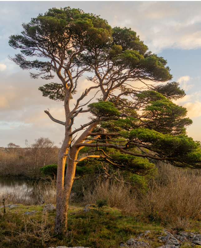
The Burren National Park, covering 1,800 hectares in the southeastern corner of the Burren in County Clare, draws its name from the Irish boíreann, or rocky place. But the Burren has been referred to as fertile rock, internationally famous for its landscape and unique flora.
Lime-loving and acid-loving plants grow beside one another, and woodland plants grow out in the open, without a tree nearby for shade – all surviving in a land that appears to be composed entirely of limestone pavement.
Explore the park’s fascinating flora and geology, discover our walking trails, or learn about how we manage the land to protect nature in the National Park. Our Information Point in Corofin, a village 8 km from the park, is open year round and provides a free shuttle bus, which runs from May to September.
The Burren National Park is situated on the southeastern side of the Burren, in north Co. Clare. To access the park, from Corofin, take the R476 to Kilnaboy. In Kilnaboy, take the right turn (L1112) before the ruined church. Approximately 5 kilometres along this road you will reach a crossroads.
While there is a small lay-by just before this crossroads on the right that can accommodate some cars, we advise visitors to avail of the free Park and Ride service from Corofin during the summer months. Then on foot, turn right, along Crag Road, and the Burren National Park lands are on your left. This is a public road so be careful of traffic.
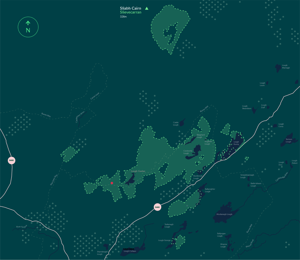
 Woodland
 This map is for illustrative purposes only and shall not be held conclusive as to the boundaries or their extent. Please note the Department of Housing Local Government and Heritage makes no representation or provides any warranty as to the accuracy, completeness or currency of this map. The use of this map, which may be altered or updated at any tiome without notice, is at the sole risk of the user.
Habitats
The limestone pavement of the Burren is part of Europe’s largest karst landscape. Limestone pavement has become synonymous with the Burren and covers most of the National Park, although usually in a mosaic with other habitats. Find out more about this unique habitat by clicking the link below.
Flora and Fauna
Orchid species flourish in the Burren. In fact, 23 of Ireland’s 27 orchid species can be found in the park. The first to flower each spring are the early purple orchid and the dense-flowered orchid. Other species here include fly orchid, bee orchid, butterfly orchid and four species of helleborine, including the rare sword-leaved helleborine.
Learning & Education
The Burren National Park Information Point is open six months of the year from April until the end of September. Our Visitor Guides also offer an outreach programme to local schools providing information about the Burren National Park and the plants and animals that live there.
There are many opportunities for hiking and walking in Burren National Park. For all the information on our trails, check out the dedicated “Hiking & Walking” section.

Protecting nature is the main aim of a National Park. Conservation work goes hand in hand with responsible outdoor recreation and visitors can help play their part by following these useful tips.

Keep to the marked trails to protect the landscape and it’s habitats.
It is important to keep to the marked trails to protect the landscape and prevent disturbance to the wildlife. Check the weather and make sure you have everything you need to bring before you set off.

Protect ancient structures
Many of the walls in the Burren are ancient structures. Please use stiles provided and refrain from climbing over walls.

Be Considerate
Remember to close any gates behind you.

Respect Privacy
No drone use is permitted without a licence and permission.
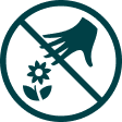
Leave What You Find
Please do not move or remove any rocks or fossils, and do not pick any plants or interfere with the wildlife.
Dispose of Waste Properly
Litter is a huge threat to nature. By bringing your waste home, you help protect the park and its wildlife, and keep the Burren beautiful.

Protect our waters
Please remember that fishing is not permitted in the lakes, turloughs or water systems in the Burren National Park.
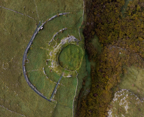
The landscape of the Burren has been home to people for millennia, with successive generations leaving the marks of their culture and traditions on the landscape. Prehistoric monuments, as well as structures from our more recent past, may be found throughout the park, while beautiful and rare wildflower meadows created through centuries of traditional farming practices adorn the landscape in summer. Our National Park staff can provide guided tours that will help bring the natural and cultural heritage of the Burren to life.
Explore learning opportunities at Burren National Park through nature and ecology themed resources for families, and discover more about the National Parks outreach programme by clicking the link below.
4 April 2024
22 March 2024
21 March 2024
Download this season’s newsletter by clicking the link.
OPEN:
Year round
ADMISSION:
Free
Corofin Information Point
OPEN:
Open daily 10:00 – 17:00
For more information please go to our Information Point page
FACEBOOK:
@burrennationalpark
INSTAGRAM:
@burrennationalpark